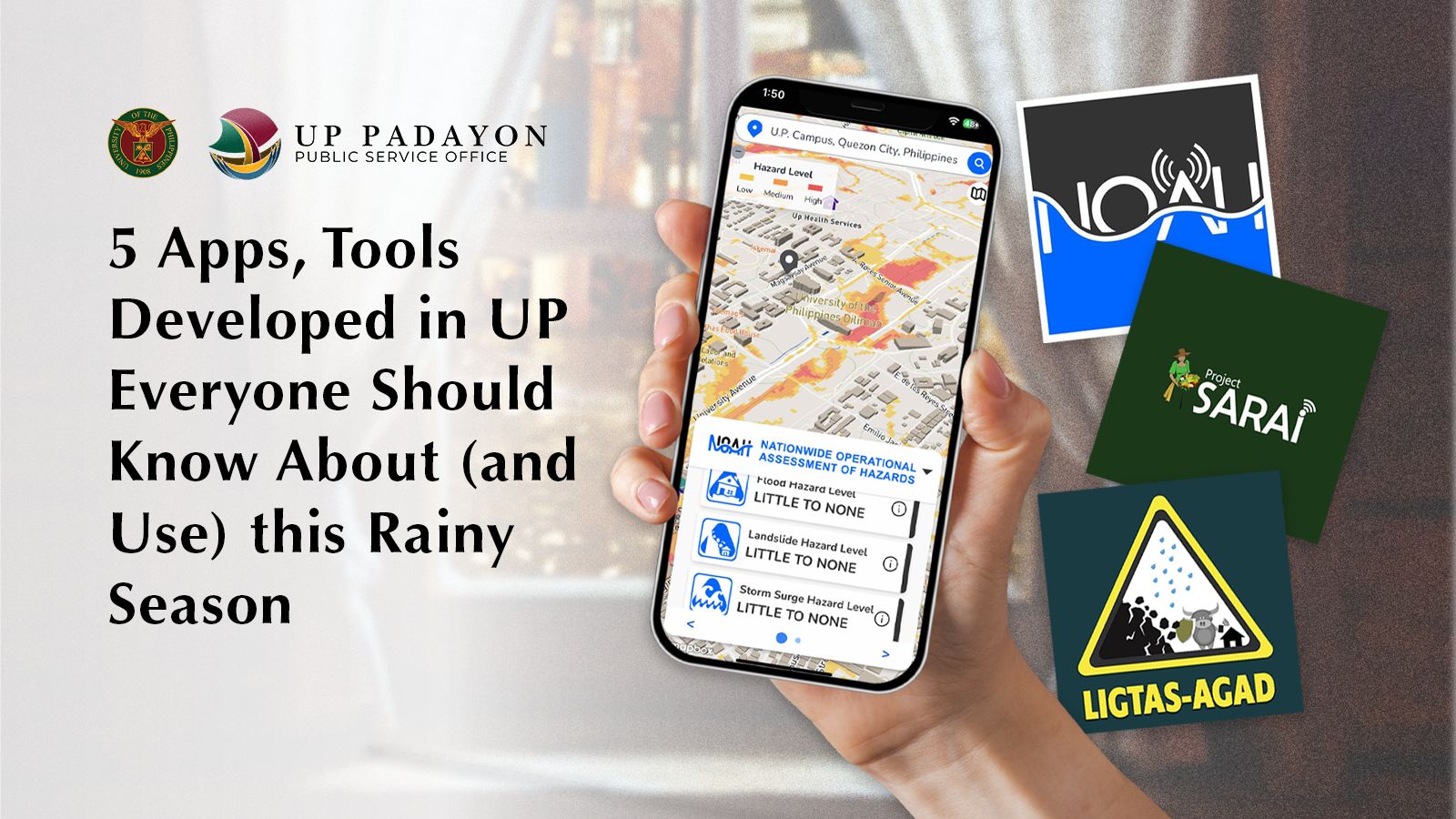
5 Apps, Tools Developed in UP Everyone Should Know About (and Use) this Rainy Season
| Written by Jan Alain Villegas
5 Apps, Tools Developed in UP Everyone Should Know About (and Use) this Rainy Season
LOOK: Here’s How UP is Helping Pinoys Stay Safe in Any Disaster
On top of being situated within the infamous Pacific Ring of Fire (which makes the country vulnerable to devastating earthquakes and volcanic eruptions), the Philippines also lies along the Western Pacific typhoon belt: a region in the northwest Pacific Ocean where nearly a third of the world’s tropical cyclones are formed.
Building a disaster-resilient Philippines is not a pipe dream. At the University of the Philippines, dedicated teams are working on all aspects of disaster management—covering all the bases—from getting ready for emergencies to carrying out rescue and relief efforts.
To aid in these efforts, we have gathered free web and mobile apps, tools, and platforms initiated by, developed at, or co-created by the University of the Philippines to help Filipinos prepare and stay safe this rainy season!
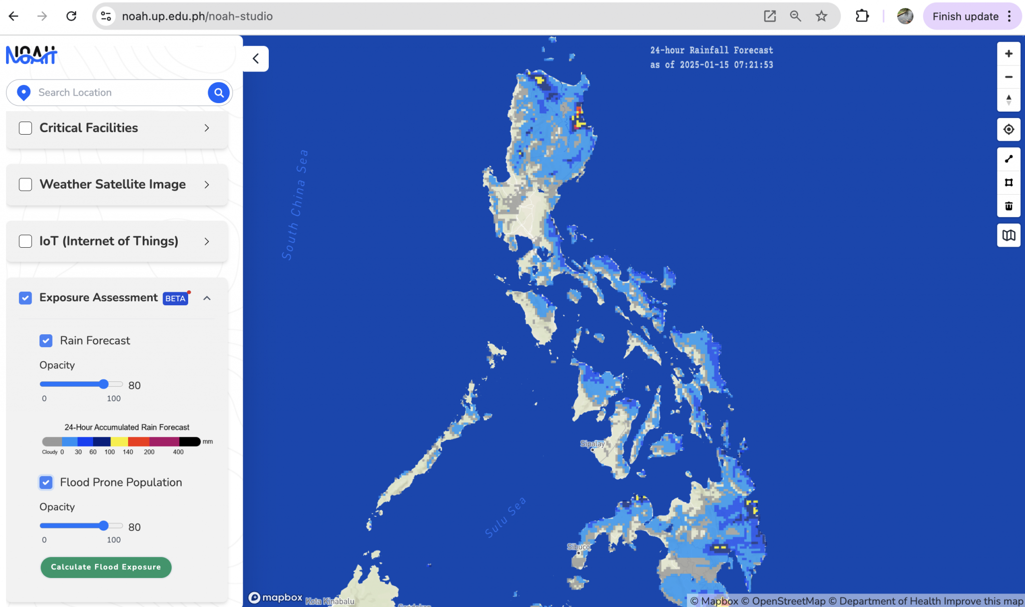
UP NOAH App and NOAH Studio
UP NOAH Center, UP Resilience Institute
NOAH Studio Web User Interface (Photo credit: Dr. Alfredo Mahar Lagmay)
The Impact-Based Flood Forecasting System is a tool that provides real-time updates on flooding, covering everything from the smallest side streets to large cities and entire provinces, using weather forecasts for rainfall and maps that highlight areas where flooding has previously happened.
With the NOAH Studio web app, you can check out if your area is at risk for floods, landslides, and storm surges (in either tabular or map form). The app even shows how many people in each barangay could be affected. It provides handy tips on what to do—before, during, and after floods. This way, you’ll have a better idea of the hazards and make smart choices when disasters strike.
UP NOAH app user interface (Screengrab from UP NOAH)
The system was developed through the collaboration of Dr. Alfredo Mahar Lagmay of the UP Resilience Institute; the UPRI Nationwide Operational Assessment of Hazards (UP NOAH) Center; and Dr. Gerry Bagtasa and Dr. Bernard Alan Racoma of the UPD-CS Institute of Environmental Science and Meteorology, in partnership with the Academic Alliance for Anticipatory Action. The project was funded by the United States Agency for International Development Bureau for Humanitarian Assistance. It was officially released in 2024.
The app is also free to download on your iOS and Android devices as UP NOAH.
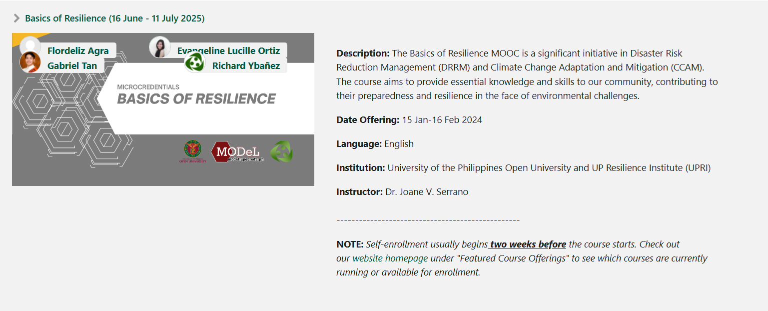
Free Courses on the Basics of Resilience
UP Open University, UP Resilience Institute
Basics of Resilience MOOC offering (Screengrab from UPOU MODeL)
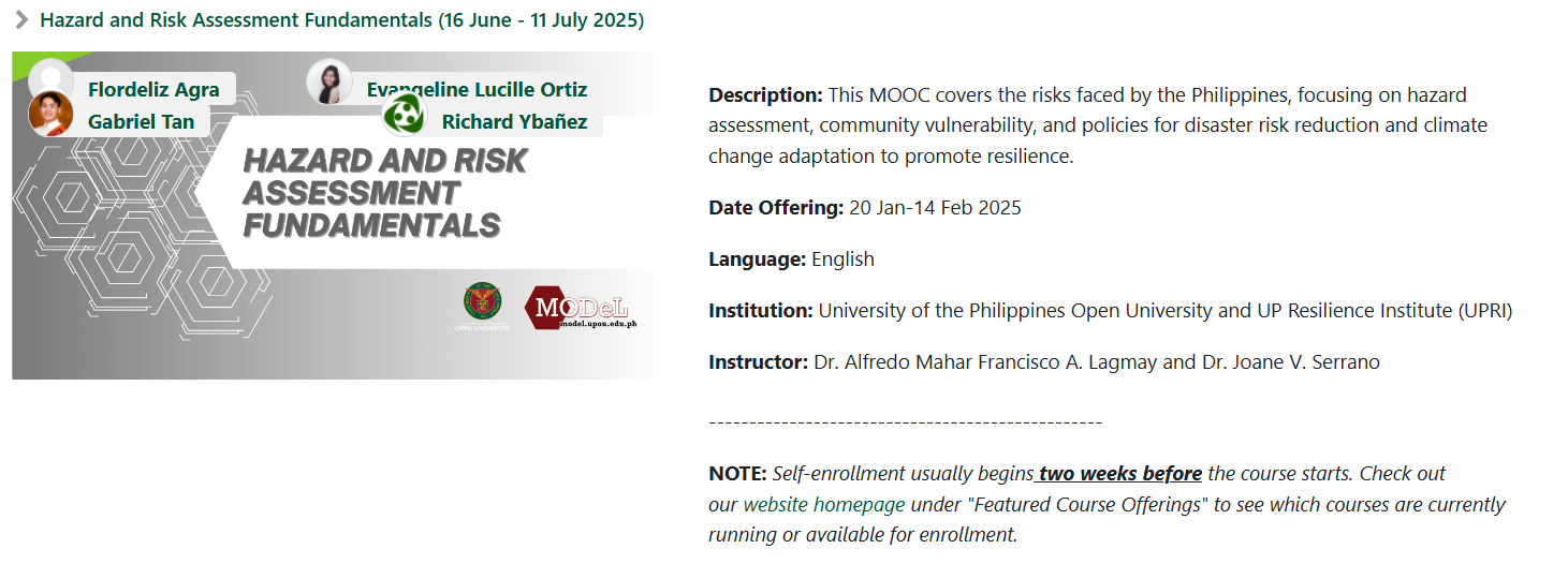
Launched in the first quarter of 2024, the massive open online courses (MOOCs) on disaster resilience have since expanded. The collaborative program between the UP Resilience Institute and UP Open University Faculty of Management and Development Studies kicked off with a free online course on the Basics of Resilience. It covers fundamental concepts related to disaster risk reduction and management (DRRM), climate change adaptation and mitigation, and resilience building. Following its initial success, UPRI and UPOU rolled out more MOOCs on Hazard and Risk Assessment Fundamentals and the Overview of Policies and Strategies for Climate and Disaster Resilience.
Hazard and Risk Assessment Fundamentals MOOC offering (Screengrab from UPOU MODeL)
A four-part MOOC, the partner institutions are on track in their development of the Resilience Strategies Across the Four Pillars, which would explore the four thematic areas of DRRM.
LIGTAS Portal Web User Interface (Screengrab from Project LIGTAS website)
In a country where landslides happen pretty often, Project Ligtas—short for Landslide Investigations on Geohazards for Timely Advisories in the Philippines—is ramping things up. Led by the UP Los Baños’ School of Environmental Science and Management (UPLB-SESAM) and funded by DOST-PCIEERD, this exciting initiative merges cutting-edge weather tech with grassroots action to predict and prevent disasters.
Project LIGTAS deploys automatic weather stations in areas at risk of landslides and volcanic activity in the Southern Tagalog region, as well as in the mineral-rich areas of the Benguet province. These stations gather hyperlocal and real-time rainfall data, which is used to forecast rainfall-induced landslides. In 2023, Project LIGTAS put out a landslide warning advisory for Baguio City as the AWS on-site reported rainfall levels exceeding the 50-mm minimum due to Typhoon Betty. Just a few days later, a landslide happened, resulting in the temporary closure of the Kennon Road.
SARAI Knowledge Portal User Interface (Screengrab from Project SARAI website)
Project SARAI, “Smarter Approaches to Reinvigorate Agriculture as an Industry in the Philippines,” is an action-research program that supports farmers and local governments in tackling sectoral challenges, especially those posed by climate change. The project gathers data from the ground and through satellites, along with crop and weather info, to create tools that give farmers early warnings to help them make better decisions.
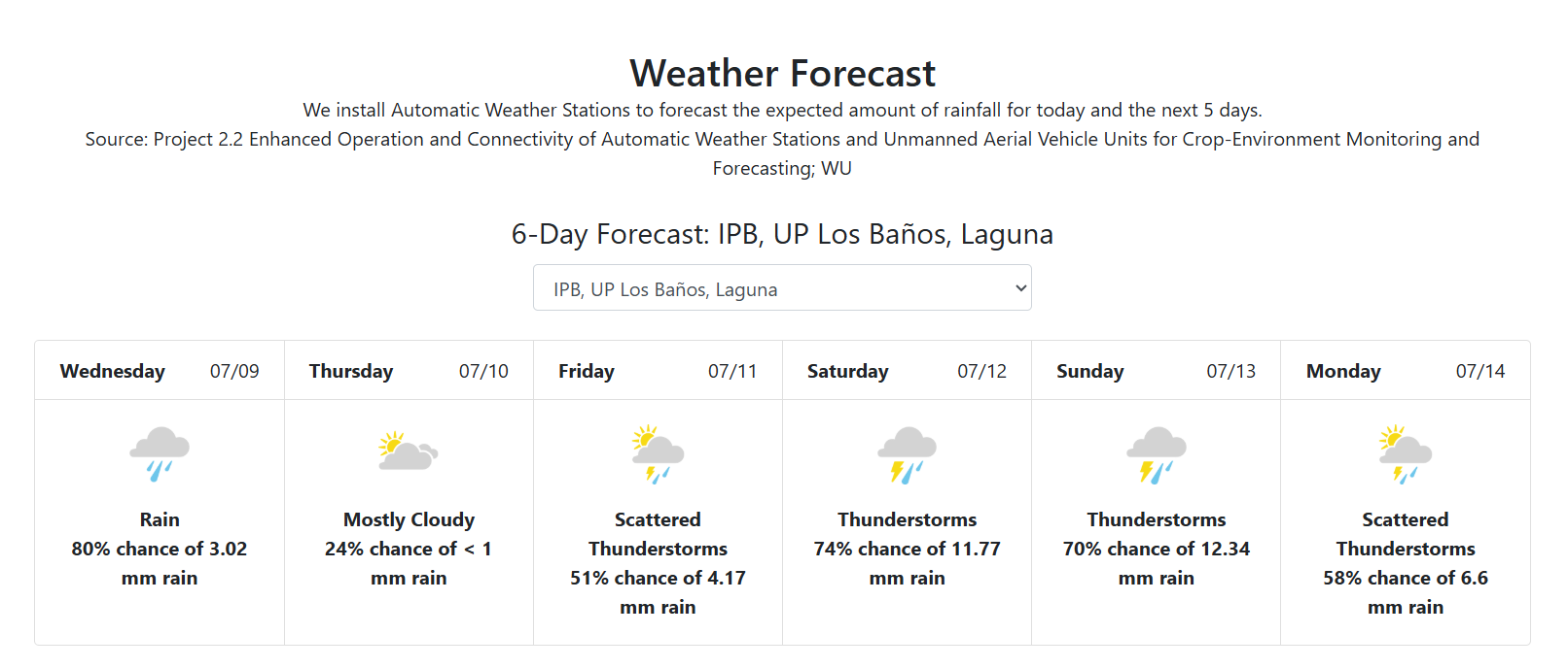
Project SARAI can forecast the expected amount of rainfall from today to the next 5 days (Screengrab from Project SARAI)
Through its one-stop SARAI Knowledge Portal, you can check out interactive maps like suitability maps, Normalized Difference Vegetation Index, rainfall maps, Standardized Vegetation Temperature Ratio maps, enhanced vegetation index, and soil profiles. It also keeps you in the loop with updates on rainfall forecasts, weather tracking, and soil characteristics.
Several digital products were also introduced by Project SARAI, including BanaTech, SPIDTECH, and the Community-Level SARAI Enhanced Agricultural System (CL-SEAMS).
Project SARAI is implemented by UPLB, under Program Leader Dr. Maria Victoria O. Espaldon, and funded by the Department of Science and Technology – Philippine Council for Agriculture, Aquatic, and Natural Resources Research and Development (DOST-PCAARRD). It is currently working with 11 state universities and colleges and 6 national government agencies.
LyfSaver App
FYT PH Media, UP NOAH Center, UP Resilience Institute
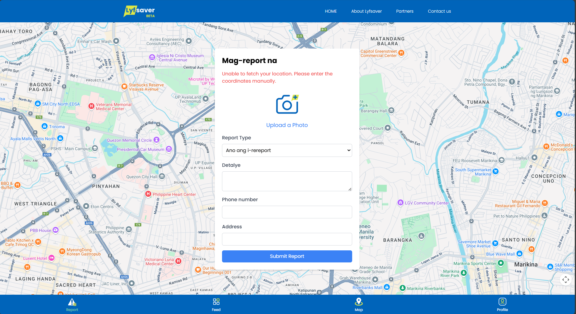
Web App User Interface (Screengrab from LyfSaver App)
LyfSaver is a crowdsourcing platform and web application that empowers Filipinos to instantly report information on natural disasters and other hazards—such as flash floods, landslides, earthquakes, and fires—in their communities.
The FYT PH Media’s LyfSaver App uses the automated features of the Impact-Based Flood Forecasting System developed by UP scientists and professors. The same features were also integrated into the DRRM components of YesPinoy’s disaster response training and the projects of the Quezon City Disaster Risk Reduction and Management Office, as well as the Public Affairs and Information Services Department.
The LyfSaver app also features verified crowd-sourced reports in its interactive map and encourages the public to sign up for its volunteer program.